Temple is a city in Carroll and Haralson counties in the U.S. state of Georgia. The population was 5,089 at the 2020 census, up from 4,228 in 2010, a 20.36% increase.
History
The name "Temple" was adopted in 1883 when the railroad was extended to the settlement, after one Mr. Temple, a railroad official. The Georgia General Assembly incorporated Temple as a town in 1883.
Geography
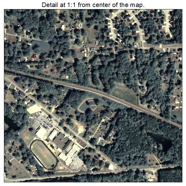
Temple is located in northeastern Carroll County at 33°44′9″N 85°1′38″W (33.735723, -85.027298). A very small portion of the city extends west into Haralson County. U.S. Route 78 passes just south of the center of town, leading east 6 miles (10 km) to Villa Rica and west 7 miles (11 km) to Bremen. Interstate 20 passes through the southernmost part of the town, with access from Exit 19, and leads east 38 miles (61 km) to Atlanta and west 48 miles (77 km) to Oxford, Alabama. Carrollton, the county seat, is 12 miles (19 km) south via Highway 113.
According to the United States Census Bureau, Temple has a total area of 6.9 square miles (17.9 km2), of which 6.8 square miles (17.6 km2) is land and 0.08 square miles (0.2 km2), or 1.38%, is water.
Demographics
As of the 2020 United States census, there were 5,089 people, 1,575 households, and 1,391 families residing in the city.
As of 2020 all of the residents of Temple lived in the Carroll County side, and no residents lived in the Haralson County side.
Education
The Carroll County portion is in Carroll County School District.
The Haralson County portion is in Haralson County School District. As of 2020 that portion had no residents.
References
External links
- City of Temple official website